I no longer visit the People’s Republic of China (PRC). As an established scholar with long-standing connections to institutions there, I feel that visiting the PRC could be seen as an endorsement of the current regime and their actions. Not visiting is a tiny and insignificant act of dissent, but one that is in my power to make.1
Having been involved with China since my first visit in 1980, this fills me with great sadness. But this is overwhelmed by the anger, frustration and sadness I feel for colleagues in the PRC, most especially for Uyghurs, but also for all those under PRC rule — including those in Tibet, Inner Mongolia and Hong Kong — who suffer in numerous ways from the government’s increasing suppression of their liberty and rights. My decision is based on the specific actions of the current regime, especially in Xinjiang. It is not about China, its cultures or its peoples.2
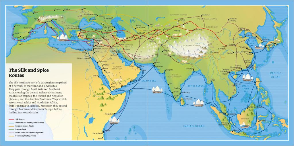
‘The Silk Roads’, my field of studies, is characterized by its cultural diversity and interactions. The active destruction of diversity within their borders by the PRC and their denial of many of the interactions which have made the regions ruled by the PRC what they are today impoverishes their history and culture. This is ironic at a time when the PRC is exploiting the term ‘Silk Road’ under the BRI to expand its political and economic influence.3
It was only towards the end of my postgraduate studies in Chinese historiography that I began to realize that approaching China as a single homogeneous civilization, as I had been taught, was pointless if I wanted to try to understand the history of this vast region. History and art books coming out of the PRC at that time talked about the ‘2000 years of history’ (since then, this has been extended to ‘5,000 years’), but this is a region with a far more complex story to tell than this tag line suggests. It has been home to numerous diverse cultures with scores of languages and many different customs and religions. In this respect it was like Europe. And like Latin, the language of one of Europe’s conquerors and that of the written corpus, one of the languages was also adopted as the language of rule: what is often called ‘classical Chinese’. But unlike Latin in Europe, use of this by the rulers as well as the elite persisted up to the 20th century.4 And, unlike Europe, much of the region is today under the rule of a single state, the PRC. The PRC’s authority now also extends to other regions which were until recently distinct in terms of culture, language, religion and, in some cases, politics — such as Tibet, the Tarim Basin (Xinjiang — 新疆 ‘New borderlands’) and parts of the steppe. The narrative of homogeneity that is currently presented by the state in its official histories is a distortion of history and one that makes China today impossible to understand.5
The subject of my PhD, the Tang-period government official and writer, Liu Zongyuan 柳宗元 (773–819) had been sent in exile to Liuzhou, which is now in Guangxi province. He wrote of arriving in a foreign land, barely touched in language or customs by the effect of distant and alien rulers from the north.
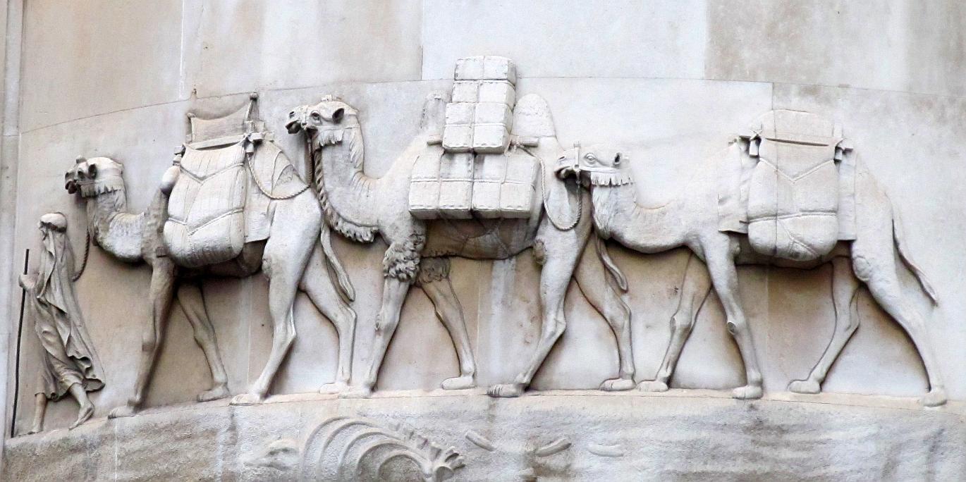
In Liu Zongyuan’s lifetime, a Turkic confederation later known as the ‘Toquz Oyuz’ or the ‘Nine Oyuz’ ruled an empire on the steppe to the north—roughly equivalent what is now Mongolia. In the official Chinese of the time they were referred to as the ‘Jiu xing’ 九姓—nine surnames —and their ruling family as the ‘Huiwu’ 回鶻 – the ‘Orkhon Uyghur’. At this time, enormous war reparations were still being paid by the Tang to this empire for their help in driving rebels from the Tang capital some decades before. A large part was paid in silk —a currency at the time—and was nominally payment for horses, which could not be bred successfully in the central Chinese plains. Horses were taken by the Uyghur Turks in their tens of thousands in markets established along the common borders. Tang princesses were sent to marry Uyghur kaghans to cement the diplomatic alliance further and Uyghurs were a common sight in the markets of the Tang capital.6
Liu Zongyuan died in exile in 819. A few decades later the Toquz Oyuz empire suffered a severe famine and their capital, Karabalghasun, was invaded by Kyrgyz from the north. Many of their people fled south, some to settle in the north China plains under the Tang where they became assimilated into the populations that now call themselves ‘Han’. Others moved into the Tarim Basin and the Hexi corridor and there established independent oasis kingdoms.
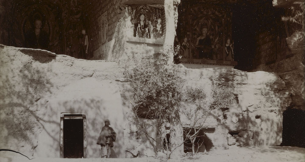
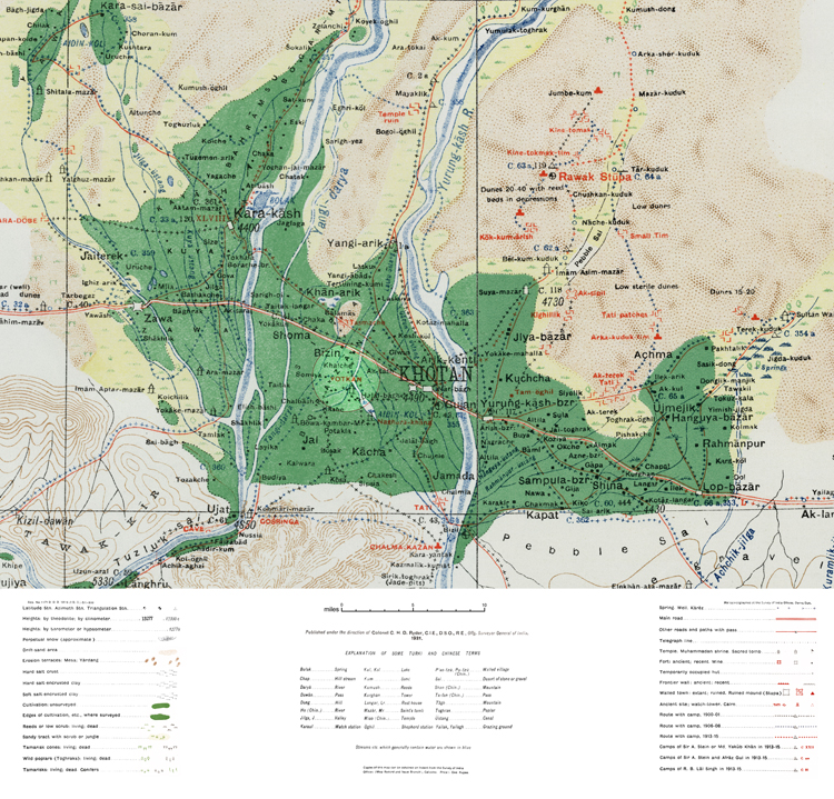
The Tang came to an end amid rebellion and bloodshed in 907, its place taken by several smaller kingdoms. The Uyghurs remained in the Tarim, alongside its already diverse populations which included settlers from India, Gandhara, Tibet, China and west and north Asia. Over time, Uyghur Turkic became the dominant language, especially after other kingdoms, such as the Khotanese, were conquered by another Turkic power, the Karakhanids. The Karakhanids were Islamic, but it was several centuries before Islam was to replace the earlier faiths of the Uyghurs, who were predominately Buddhist at this time. Mosques were built alongside the stupas with many Islamic mazar located at the sites of existing shrines.7
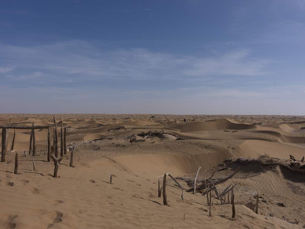
After my PhD, I started to work on the ‘Silk Roads’, specifically looking at the Tarim Basin of Central Asia and the routes through it into the north China plains and the Yellow river valley in order to try to understand the interactions between the numerous cultures in this region, including those in what we now call China. These routes — and interactions — naturally extended north from the Yellow River valley and plains into the steppe and south and southwest into the sub-tropical mountain regions beyond the Yangzi river, the land of Liu Zongyuan’s exile.
Others have written of the colonization of this region by the Qing empire in the 19th century and, more recently, about the settler colonialism of the PRC.8 This did not lead to an immediate extinction of the culture. Indeed, in the style of the Soviet Union, ‘minority cultures’ were celebrated in the early PRC. A the same time, however, it was clear that they were being packaged as state-managed artefacts, fitting the trope of peoples whose main activities are singing and dancing.9
This has now changed. Since at least the meeting of the Central Forum on Ethnic Work in September 2014, the PRC’s official aim for these ‘minority cultures’ has shifted to jiaorong 交融 ‘mingling’— a term implying assimilation.10 The practical application of this policy in Xinjiang in particular has led to programmes designed deliberately to eradicate significant parts of a culture: including its languages, religious practices and beliefs.11 The Chinese government openly acknowledges the application of these policies, albeit in terms such as “vocational education” or “thought transformation”. They are implementing these policies at a dismaying speed and scale.
We are in the midst of losing a part of the history and diversity that, as Hannah Arendt said, make us human.12 In terms of human lives, this means that as I write this there are individuals in their thousands or tens of thousands who are mourning relatives, imprisoned and sometimes dying in the camp and prison systems; mourning the language they and their children can now barely speak or read; the children they can no longer bear; the religion they can no longer follow; and the history and identity of their peoples that is being eradicated. Everyday there are countless moments of mourning directly owing to the deliberate policy of the PRC.
Notes
1. My last visit was in 2018 and was a deeply uncomfortable experience because of the dissonance between what was evident—for example, the disappearance of a whole neighbourhood of Uyghurs and their businesses—and what was acknowledged and spoken about. I have never visited Tibet, primarily because of PRC colonialism and its repressive policies there. For a discussion of the effect on Tibetan identity by PRC colonialism see Gerald Roche, Tibet, China, and Settler Colonialism”, Cornell East Asia Program, April 13, 2021 and Gerald Roche, James Leibold and Ben Hillman ‘Urbanizing Tibet: differential inclusion and colonial governance in the People’s Republic of China, Territory, Politics, Governance.‘ 2020.
2. The ‘Xinjiang Victims Database’ (https://shahit.biz/eng/) is testament alone to the policies of the PRC in this region. For the need for careful appraisal and presentation of evidence see Rune Steenberg, ‘Suppression of the Uyghurs: Let’s stick to the facts.’
3. I am currently working on an article on the influence of BRI on cultural heritage policy and practice in the PRC.
4. Language use in China is far more complex than usually presented. For example, it is assumed by many that the written language is always the usually called ‘classical Chinese’ and that vernaculars did not generally appear in texts until quite late. But, as some scholars have shown, vernaculars are present in texts from much earlier. See, for example, Victor Mair on the poetry of Hanshan (fl. 9th c.) (https://www.jstor.org/stable/603705) and Imre Galambos on manuscripts written in Dunhuang, on the borders of the Tang. The diversity of vernacular languages in the Chinese language group are thus under-explored, let alone the numerous other languages prevalent in this region. For Turkic languages in the PRC, see Arienne Dwyer, ‘Endangered Turkic Languages of China.’ Chinese languages are also currently under threat, notably Cantonese which has thrived partially thanks to it use—spoken and in print—in Hong Kong. See Victor Mair, ‘Cantonese Under Renewed Threat.’
5. Some of these regions had been previously occupied by the Manchu Qing rulers (1644–1911). See James A. Millward, Eurasian Crossroads: A History of Xinjiang, New York: Columbia University Press, 2021.
6. See my chapters on the princess and the soldier in Life Along the Silk Road.
7. For mapping of many of the mosques and mazars see https://xjdp.aspi.org.au/map/? Because their history stretches back to before the Islamic conversion and, in some cases, marks spots that were sacred long before the Uyghur’s move to this region, their destruction extends beyond Uyghur culture. Rahilä Dawut, a professor at Xinjiang University, has researched and written on these, see, for example, she her ‘Shrine Pilgrimages among the Uyghurs.’ Rahilä Dawut was detained in December 2017 and her whereabouts remain unclear.
8. For example, Millward (note 5).
9. For a discussion of the early adoption of the Soviet Unions ‘diversity’ policy by the PRC see Thomas S. Mullaney, ‘How China went from celebrating ethnic diversity to suppressing It.‘ On the trope of ‘singing and dancing minorities’ in China see Rachel Harris, ‘The New Battleground: Song-and-dance in China’s Muslim Borderlands.’ and Anon. ‘You Shall Sing and Dnce: contested ‘safeguarding’ of Uyghur Intangible Cultural Heritage.’ Asian Ethnicity 22.1: 121–139.
10. Central Ethnic/Nationality Work Conference as well as the 6th Ethnic/Nationality Unity Commendation Conference of the State Council. See James Leibold, ‘Xinjiang Work Forum Marks New Policy of “Ethnic Mingling“.’ China Brief 14:12 and for the implementation of policies for other ‘minorities’ see James Leibold ‘Beyond Xinjiang:_Xi Jinpings Ethnic Crackdown.’
11. Nick Holdstock gives a reading list on the recent history of the Uyghurs in Xinjiang under the PRC.
12. ‘an attack upon human diversity as such, that is, upon a characteristic of the ‘human status’ without which the very words ‘mankind’ or ‘humanity’ would be devoid of meaning.’ Hannah Arendt. Eichmann in Jerusalem: A Report on the Banality of Evil. London: Penguin 2006: 235.
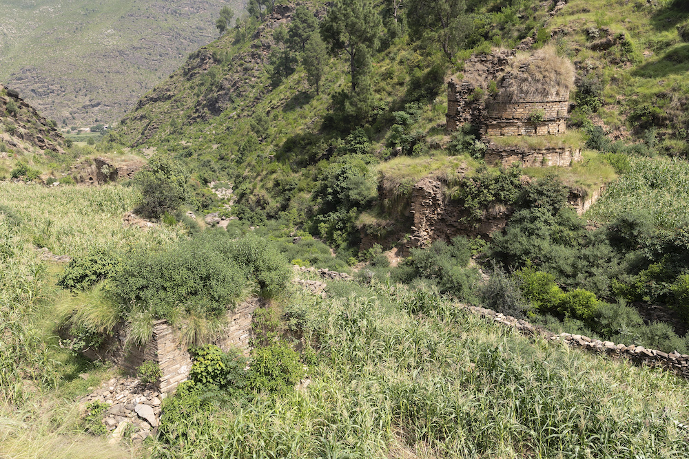
Photo caption: A modern mazar on the slopes of the remains of a Tibetan military fort on the Khotan river in the Tarim Basin. The fort dates from the period of the Tibetan rule of Khotan (792-851). Photograph by John Falconer, 2008.